


Voting District 47, Wood County, West Virginia
About
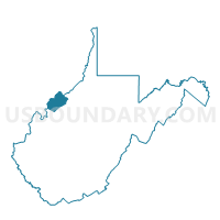
Outline

Summary
| Unique Area Identifier | 692090 |
| Name | Voting District 47 |
| County | Wood County |
| State | West Virginia |
| Area (square miles) | 3.82 |
| Land Area (square miles) | 3.28 |
| Water Area (square miles) | 0.54 |
| % of Land Area | 85.79 |
| % of Water Area | 14.21 |
| Latitude of the Internal Point | 39.34418920 |
| Longtitude of the Internal Point | -81.52802660 |
Maps


Graphs
Select a template below for downloading or customizing gragh for Voting District 47, Wood County, West Virginia


Neighbors
Neighoring Voting District (by Name) Neighboring Voting District on the Map
- Voting District 40A, Wood County, WV
- Voting District 44, Wood County, WV
- Voting District 44A, Wood County, WV
- Voting District 45, Wood County, WV
- Voting District 45A, Wood County, WV
- Voting District 46, Wood County, WV
- Voting District 46A, Wood County, WV
- Voting District 46B, Wood County, WV
- Voting District 48, Wood County, WV
- Voting District 49, Wood County, WV
- DUNHAM EAST Voting District, Washington County, OH
- WARREN SOUTH Voting District, Washington County, OH
Top 10 Neighboring County Subdivision (by Population) Neighboring County Subdivision on the Map
- Parkersburg district, Wood County, WV (29,163)
- Williams district, Wood County, WV (13,532)
- Warren township, Washington County, OH (4,045)
- Dunham township, Washington County, OH (2,568)
Top 10 Neighboring Place (by Population) Neighboring Place on the Map
Top 10 Neighboring Unified School District (by Population) Neighboring Unified School District on the Map
- Wood County School District, WV (86,956)
- Warren Local School District, OH (14,351)
- Belpre City School District, OH (8,733)
Top 10 Neighboring State Legislative District Lower Chamber (by Population) Neighboring State Legislative District Lower Chamber on the Map
- State House District 92, OH (123,037)
- State House District 93, OH (116,725)
- State House District 10, WV (55,234)
- State House District 8, WV (18,237)
Top 10 Neighboring State Legislative District Upper Chamber (by Population) Neighboring State Legislative District Upper Chamber on the Map
Top 10 Neighboring 111th Congressional District (by Population) Neighboring 111th Congressional District on the Map
Top 10 Neighboring Census Tract (by Population) Neighboring Census Tract on the Map
- Census Tract 202, Washington County, OH (6,942)
- Census Tract 103, Wood County, WV (4,512)
- Census Tract 105.02, Wood County, WV (4,462)
- Census Tract 203, Washington County, OH (3,696)
- Census Tract 101.01, Wood County, WV (1,943)
- Census Tract 101.02, Wood County, WV (1,890)
- Census Tract 104, Wood County, WV (1,721)